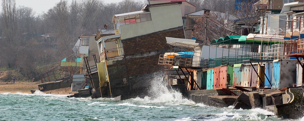

Coastal erosion is the wearing away of land, rocks or sand along the coastline. In addition to natural forces from the sea such as storm surges and sea level rise due to climate change, many human activities like harbour construction, maintenance dredging and more, all contribute to the erosion process.
We ask Kasper Kaegaard, our Senior Coastal Expert, five questions on coastal erosion to find out how we can protect our shorelines from this ongoing challenge.
Q: Why should we be concerned about coastal erosion?
A: Coastal erosion is important because most of the world’s population live in cities close to the sea or ocean and most of these areas are threatened by coastal erosion. Often the coastal erosion is cause by manmade structures or other interventions in the natural coast. The risk from coastal erosion is mainly to infrastructure, i.e. houses or roads being damaged during storms, but also to the amenity of the coastal landscape. Many people enjoy the beach and coastal landscape and if the beach is eroded away, this reduces the quality of life of the people who would otherwise enjoy the beach. Studies of housing prices have shown a clear trend for increases in housing prices where beaches are nourished, a clear indication of the value people put on access to high quality beaches.
Good solutions to coastal erosion require skilled engineers and architects working together to create coastal schemes which both address the risk from coastal erosion to infrastructure and create nice beaches and waterfront areas for people to enjoy. The biggest challenge in these projects are both technical – since good solutions can be difficult to design and require a high level of understanding of the natural coastal processes – and financial; that is, who should pay for the coastal protection?
The problem is often that the people benefiting the most from a solution to a coastal erosion problem, i.e. the people in the first row of houses, are not interested in an integrated solution with a wide public beach because that may attract the crowds to the area. So the onus is on the authorities to manage this challenge.
Q: Where should one start when evaluating possible solutions to tackle this challenge?
A: To evaluate possible solutions to a coastal erosion problem, we need basic data from the site such as historical shoreline position, waves in the area and sediment properties. This information can now usually be obtained from online sources, i.e. historical satellite images, MetOcean Data Portal etc. With this basic information, a screening of possible solutions can already be started.
Based on the screening process, a selected solution can then be brought forward to a concept design stage where a consultant will conduct more detailed studies of the waves, flow and sediment transport in the area to determine the needed lengths of the supporting structures and more exact details on the volume of sand needed for the scheme. Depending of the complexity of the area and the solution, more or less detailed studies are needed for the design of the scheme. The most complex schemes involve submerged structures in high wave energy and highly built-up areas where mistakes may have severe consequences. There are many examples of coastal protection structures which did not work as designed because the interaction between, for example, submerged structures and the coastal processes can be difficult to predict. However, with new tools developed over the past coupled of decades, we have fortunately become much better at this.
Q: In what ways can water modelling help us mitigate the effects of coastal erosion? Can you give us a few modelling scenarios?
A: In coastal studies, we always rely on a combination of data and numerical modelling. At DHI, we mostly use process-based models for coastal processes which we first calibrate to match the observed data. Other models also exist, such as empirical models which are essentially simpler equations being fitted to match the observed data of e.g. beach profile evolution or evolution of beach position. The problem with fitting empirical models to match observed data is that the behaviour of the model when a proposed beach scheme is introduced may not be covered by observed data. Therefore, the uncertainty of the predicted response is relatively large. With a process-based model, the model assumptions are much more fundamental which means that when the model has been calibrated to the local data, the uncertainty when predicting the coastal response of a proposed beach scheme is much smaller.
Of course there is a cost associated with using process-based models and that is increased runtime. However we think it is better to wait a little longer to get a correct robust result rather than designing a coastal scheme which does not behave as planned.
Q: What kind of capabilities should coastal engineers and consultants look out for when determining the type of modelling software to use for their projects?
A: It is important that the modelling software is as process-based as possible. What I mean by that is as many hydrodynamic, wave and sediment processes as possible should be included. This limits the amount of assumptions in the models which in turn reduces the uncertainty of the predictions of the calibrated models.
Furthermore, I find it very important that the models are easy and intuitive to use. This increases my productivity which is good, but it also reduces the number of mistakes I make when setting up and running the models. Let’s be honest: We all make mistakes, but when using models with good workflows and clear user interfaces, we make much fewer mistakes.
For our more complex coastal projects, I could not do my work without a model which takes 2D sediment transport effects into account and can run long term simulations.
Q: What do you foresee as the future of coastal protection?
A: Coastal erosion will become a large challenge in the future due to increased pressure from rising sea level because of climate changes and due to expansion of cities in coastal areas. There is also a growing focus on the recreational use of beach and nearshore areas as surfing and other watersports are becoming increasingly popular. The trend is therefore more and more towards integrated solutions which address both the risk to infrastructure and beach amenity.
I think the tools we are using now will become more accurate in the future and include more processes directly, however the complexity of the coastal system is such that high-quality data will always be needed. A stronger integration of models and data will likely improve our predictions and designs further.
With respect to digital solutions, I see a clear benefit from integrating the models and data the model consume in the cloud. This has already happened to some extent with online wave data, shoreline positions etc., and I think we will see more of this in the future.
Empower your coastal resilience planning through modelling
Contact us and explore shoreline management solutions that can help you solve coastal instability and flooding related challenges all around the world.
Wait… before you go
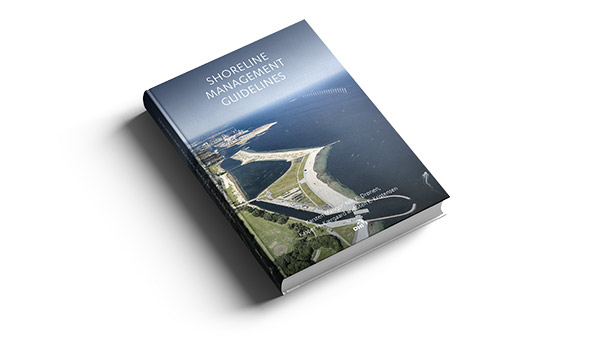
Download your free copy of the Shoreline Management Guidelines eBook, a practical guide to provide a common basis for shoreline management for coastal planners, engineers and authorities.