

The potential of geothermal energy as a carbon-neutral and renewable resource is gaining traction as the global population increases and awareness of climate change grows. Geothermal installations harness heat from the earth to produce electricity, making them a viable option for countries looking to meet their increasing energy demands while reducing carbon emissions.
The principle of geothermal energy is simple: the idea is to pump hot water from deep underground aquifers and use it for the generation of district heating. Unlike other renewable energy sources such as wind, solar and tidal, geothermal is entirely predictable and does not rely on weather patterns.
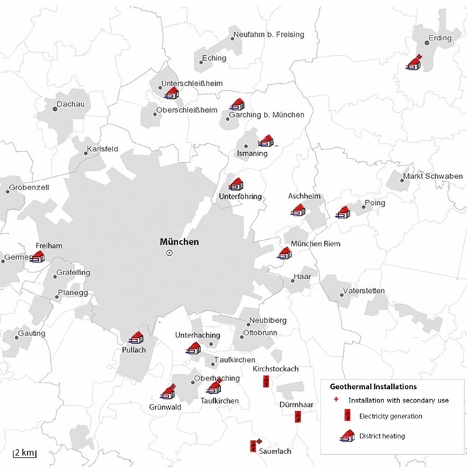
More and more municipal companies around the world are setting ambitious goals to meet carbon-neutral energy demands. An example is Stadtwerke München (SWM), one of the largest municipal companies in Germany. According to its sustainability report, the company aims to mainly rely on deep geothermal energy to ensure carbon-neutral coverage of Munich’s demand for district heating by 2040.
How feasible is this? A recent research project by the Leibniz Institute for Applied Geophysics (LIAG), the Technical University of Berlin and DHI investigates.
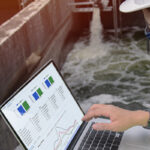
To use geothermal energy, we first need to understand what is beneath the earth
For geothermal to be used as an energy source, we first need to understand what is beneath our feet. Since mapping an entire deep geothermal reservoir of the earth is an impossible task, our understanding of the earth’s subsurface is based on existing information such as geological maps and cross-sections, boreholes, seismic campaigns and other field data. With these insights, a virtual 3D representation of the area – which can cover several kilometres – is created. This 3D representation is typically known as a ‘digital twin’ in other disciplines. However, such terminology is still not frequently used in the geothermal context. In this article, the representation will be referred to as a ‘model’ for ease of understanding. This model is crucial for recognising the geothermal potential and will determine the feasibility of achieving carbon-neutral energy production in an area using geothermal.
The limitations of existing methods in getting an accurate picture
Today, a geothermal project involves multiple disciplines, and all do their best to depict the flow and heat several kilometres beneath the earth’s surface. But how accurate is this picture?
With each arrival of a new dataset, what has been previously considered the ‘true’ reality of the reservoir becomes questionable. Yes, the model can be adjusted; but the challenge goes beyond that. What if there wasn’t just one version, but hundreds or even thousands of this ‘reality’ based on what we know from the new data? How can all this new knowledge be used to keep the representation up to date? And what is the probability of ‘picking’ an inaccurate representation for a particular geothermal project?
New approach offers multiple reservoir representations for higher accuracy
A research project between DHI, Leibniz Institute for Applied Geophysics (LIAG) and Technical University of Berlin addressed the above questions, using a prominent geothermal reservoir in the Bavarian Molasse basin as a study case. Existing data from The Project GRAME – a separate research project by SWM, LIAG and other institutions – as well as geological and operational data of the geothermal reservoir, were used as input to the methodology.
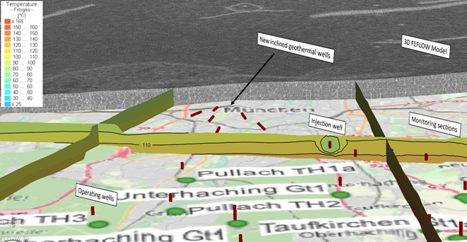
The team developed a 3D numerical model of the Greater Munich area (approximately 2,700 km2) using a subsurface simulator. State-of-the-art 3D meshing algorithms were tested to map field data, such as fault inclinations, deviated borehole trajectories and more, as much as possible.
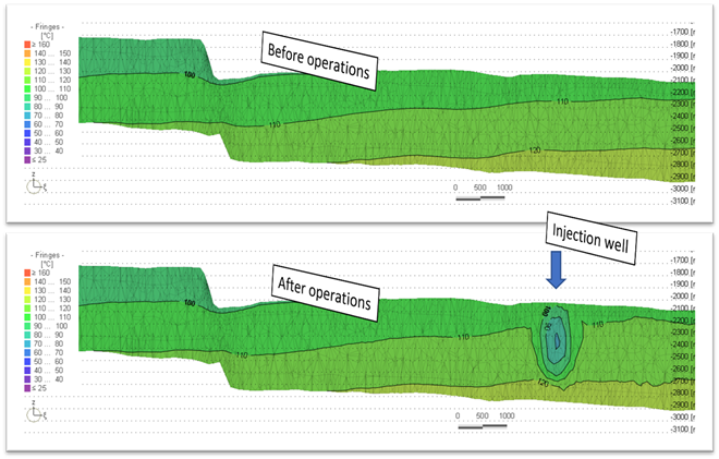
In comparison to a traditional geothermal project where only one reservoir exists, this methodology allows the creation of hundreds or even thousands of statistical-probable reservoir representations. Not only can this approach reproduce historical measurements such as the reservoir’s pressure and temperature in the last years, it can also be used to test the feasibility of future geothermal locations and their impact on the reservoir.
Using this approach, the research team tested 12 potential geothermal installation locations in Munich’s city centre and successfully validated their effectiveness for district heating.
More effective decision-making and risk mitigation for geothermal projects
Compared to traditional modelling, this approach does not deliver only one answer, but offers up to thousands of possibilities, of course also including best- and worst-case scenarios. This will benefit municipal companies like SWM, since knowing potential impacts in advance will help them mitigate risks and determine the feasibility of possible geothermal projects.