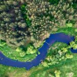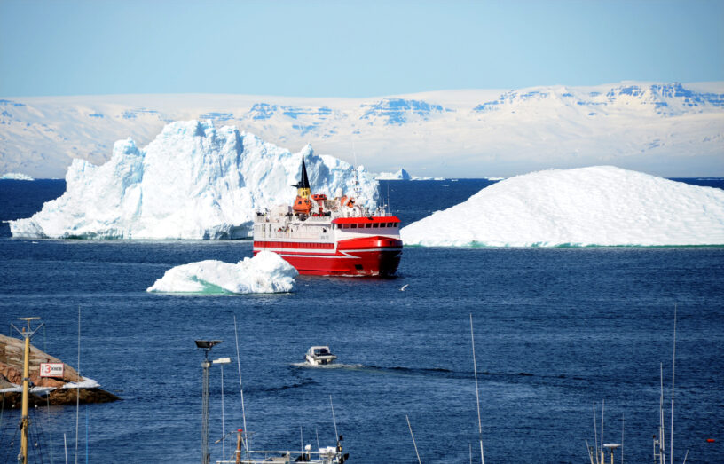

Navigating Greenland’s waters is a high-stakes challenge. With vast coastal zones left uncharted and dynamic tidal systems at play, local maritime operators, supply vessels and naval forces must rely heavily on experience and onboard tech when entering uncharted maritime zones. The EO4Hazards research project offers a scalable, satellite-based approach to enable better situational and operational maritime awareness. This will be achieved through improved data on Arctic maritime conditions, starting with mapping risk zones within selected areas along the west coast of Greenland and supplementing this data with bathymetric maps for shallow waters and updated tidal information anywhere and anytime in the area.
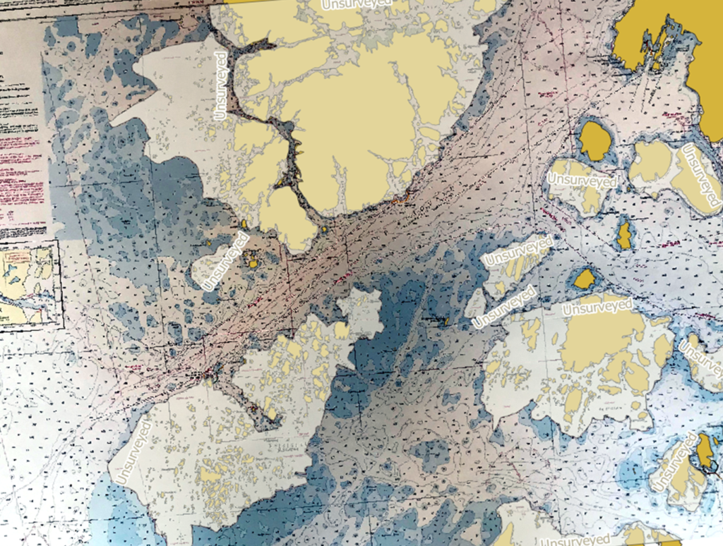
(Danish Geodata Agency. (2012). Paper Chart: Nuuk (Godthåb) (Chart No. 1331, 4th ed.))
EO4Hazards is conducted by DHI in close collaboration with the National Defence Technology Centre, DTU Space and Greenland’s Institute of Natural Resources. The project combines satellite data, AI, field data and local expertise to generate machine learning models that can deliver maritime situational awareness in remote Arctic regions. The project focuses on detecting submerged navigational hazards and generating shallow-water bathymetry in Greenlandic coastal waters where traditional marine surveys are sparse or non-existent. Further, the project will develop novel methods for determining the tidal conditions anywhere and anytime in the region.
The consequence of the current lack of environmental information is compromising safety at sea in the region. The Maritime and Aviation Rescue Council recently concluded that the efforts of the maritime and air rescue service for the year 2023 were only partially satisfactory, as the targets for rescue and preparedness were not met. Better environmental situational awareness will contribute to achieving and surpassing these targets in the future.
As examples, two incidents occurred only a month apart in 2023:
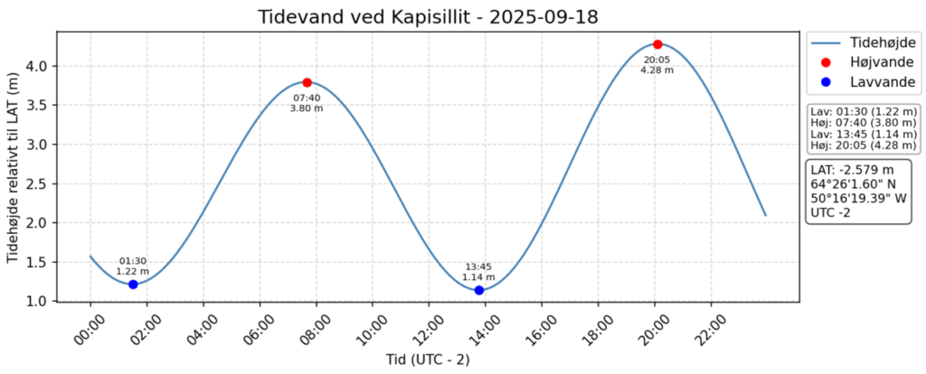
On 31 August, the supply ship, Ivalo Arctica, from Royal Arctic Line stood on the sea floor in the harbour of Kapisillit, Greenland. The ship was grounded in the harbour for four hours due to an unexpected low tide. Damages were minimal, but the ship had to be temporarily taken out of service.
Less than two weeks later, on 11 September, the cruise ship Ocean Explorer ran aground in Alpefjord. 206 passengers and crew members were onboard. Luckily, no one was hurt. After three days stuck on the mud bank at this remote location, and in calm and sunny weather, the ship was pulled free at high tide intact.
Satellite insights over the Arctic
At the heart of the approach is the use of data from the new SWOT satellite (Surface Water and Ocean Topography), which offers unprecedented data to provide insight into Arctic tidal conditions. This is combined with satellite data from the European Copernicus programme and from NASA’s Icesat-2 satellite and processed using novel machine learning techniques tailored to the local geography and climate.
The result is a set of satellite-derived maritime products that map not only the seabed topography but also dynamic conditions such as tides, inter-tidal zones and changing coastlines. These outputs are designed with end users in mind to ensure that data can be delivered in relevant practical formats such as KML, TimeZero or AMLs (additional military layers), making integration into existing navigation or planning systems straightforward.

How it will be used: Operational testing
While the Arctic may feel distant to most, its coastal waters are a daily reality for local people and authorities, supply chains and search and rescue teams. Yet navigating these waters safely remains a major challenge due to limited basic nautical data, including bathymetry and fast-changing tidal regimes.
That is why EO4Hazards is not just a technical research project: it’s being tested in close collaboration with those who operate in the Arctic every day. The project team is working alongside the Danish Navy, Greenland Police, Royal Arctic Line and other maritime operators in Greenland to validate and assess the generated data products under real-world conditions. This hands-on validation will help refine both the data products and its practical applications.
The goal is to understand how the new satellite-derived maps and tidal models perform during actual operations at sea. For instance, the Greenland Police may use the data to support safe routing in shallow unsurveyed fjords, while the Danish Navy may evaluate the data for patrolling or strategic planning in remote areas.
Feedback from these operational partners will be critical, not just for technical validation, but also to uncover new use cases and assess how the data can be integrated into decision-making workflows. That includes evaluating how well the information fits into existing digital navigation systems, planning tools or other data platforms already used by maritime authorities.
In other words, the testing phase is not only about assessing and improving the accuracy of the data solutions. It is also about ensuring that the solutions are fit for purpose; practical, usable and adaptable in dynamic Arctic conditions.
EO4Hazards is a collaborative project, bringing together technical experts from DHI and DTU Space – Department of Space Research and Space Technology at Technical University of Denmark, with regional knowledge provided by the Greenland Institute of Natural Resources. The workflows and models build on previous project work, e.g. from the DHI-led NANOK project, where the stepping stones were laid in collaboration with the Danish Ministry of Defence Acquisition and Logistics Organisation (DALO).
The EO4Hazards research project is funded by NFC – The Danish National Defence Technology Centre.
What’s next: Future impact
Together with stakeholders, the EO4Hazards team is creating a flexible, scalable method for mapping shallow Arctic waters that can adapt to different user needs and operational contexts. The project will provide local authorities and maritime operators with clearer insight into shallow Arctic waters and tidal variation, helping them plan and carry out operations more safely and effectively.
The project team will host an open workshop in Nuuk in September 2025 at the Greenland Institute of Natural Resources.
The intent of the workshop is two-fold:
- To inform as broadly as possible about these new technologies that can provide information to open new areas and routes for sea transportation for smaller vessels.
- To get feedback on the solutions from stakeholders and discuss how the solutions may be designed to generate maximal value for them.
The time and date for the workshop is Wednesday, 10 September, 09:30– 12:00. It will, unfortunately, not be possible to participate online.
Want to learn more about EO4Hazards and how satellite-derived bathymetry can support Arctic operations? Please get in touch with Niels Broge (nibr@dhigroup.com) or Mikkel Bojesen (mihb@dhigroup.com).