


Modelling in practice is DHI’s new series that explores how modelling helps us interpret complex water environments and turn scientific insights into practical decisions.
Hydrological modelling covers an extensive spectrum of water‑management needs, including river forecasting, hydropower operations, reservoir planning and much more. In this Q&A, Kean Foster, Project Manager and Specialist in Water Resources, offers a practical look at how modelling supports these decisions and reflects on what continues to make the discipline meaningful for him.
Q: When people ask what you do, how do you describe hydrological modelling?
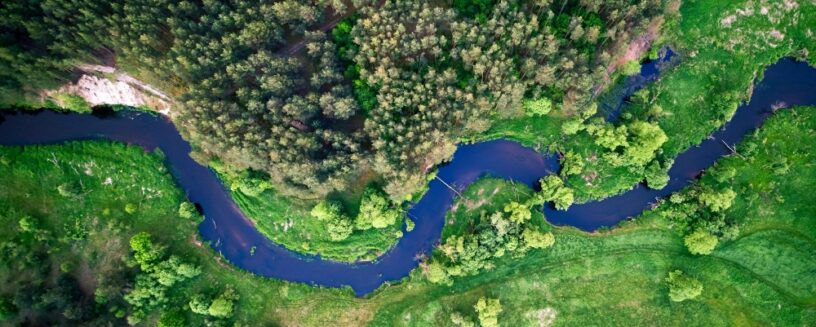
I usually say I build simplified digital versions of reality. A model, if you will, of how water moves through the landscape, from the moment precipitation hits the ground to when it ends up in a river, a reservoir or an aquifer.
At its core, a hydrological model is a set of mathematical relationships that simulate what nature does, but in a way that we can interrogate, manipulate and use to plan ahead.
The key word is simplified. No model perfectly replicates what happens out there. One of my mentors, Sten Bergström (the father of the HBV rainfall–runoff model), had a wonderful way of making this point. He’d ask you to think of two model aeroplanes, a cheap rubber-band-powered toy and a perfect scale model of a Spitfire. Which one can actually fly? The point being that fidelity to appearance isn’t what matters; capturing the right behaviour is. A good model doesn’t need to look like reality. It needs to act enough like it to be useful.
That’s why I sometimes tell people it’s like a flight simulator for water, a computer environment that simulates how water moves through a system, and then lets you dam it, divert it, store it, release it and explore what happens next. Most of my work is built in MIKE HYDRO and increasingly MIKE+, which between them cover everything from basin-scale water resources modelling to detailed river hydraulics.
Q: Where is hydrological modelling most commonly applied in practice?
Hydrological modelling shows up in an enormous range of practical contexts. One of the most visible is river flow forecasting, providing advance warning of floods, or informing irrigators and water managers how much water they can expect in the coming days, weeks or season. This is critical work: late warnings can lead to unnecessary economic losses or, in the worst cases, loss of life.
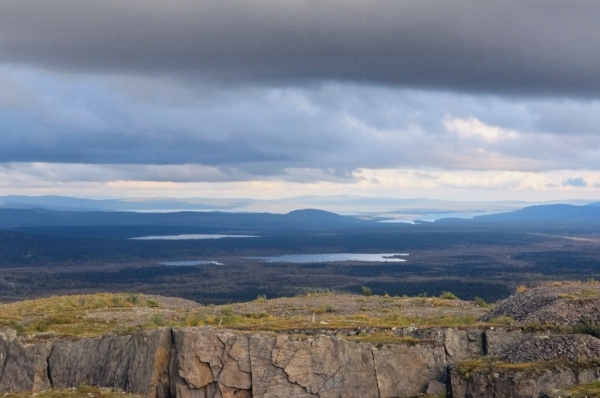
Another major area is water resources planning. Here, models help determine whether a proposed reservoir can reliably supply a growing city, whether a catchment can sustain both agricultural abstractions and ecological flow requirements or how a system will respond to climate variability and change.
Hydropower operations depend heavily on inflow forecasts and long‑term yield modelling to schedule generation and manage storage. Drought monitoring, environmental flow assessments and infrastructure design also rely on hydrological modelling in one form or another.
Beyond these well-known applications sits a layer of work that the public rarely sees. Flood mapping, identifying which areas are at risk under different return periods, underpins land‑use planning, insurance pricing and emergency preparedness. Design flow estimation influences the sizing of bridges, culverts, spillways and stormwater systems. Underestimate design flows and you build in failure risk; overestimate them and you inflate project costs.
In the hydropower sector, dam safety assessments depend on robust estimates of extreme inflows, where historical records are often too short to characterise rare but consequential events. The mining industry is another often-overlooked domain: mines alter groundwater regimes through dewatering, rely on accurate site‑wide water balances and must design tailings and water management infrastructure to withstand extreme rainfall. These tasks may be unglamorous, but the consequences of poor modelling can be long‑lasting and severe.
Hydrological modelling supports better decisions about a resource that is variable in both space and time and inherently uncertain. Whether a reservoir operator is planning tomorrow’s release, a government is evaluating a major water‑transfer scheme or a mine is demonstrating that its operations won’t compromise downstream water quality, the model provides a structured and transparent way to weigh options. It helps decision‑makers understand not only what the hydrology is likely to do, but also what it might do under less favourable conditions, and that insight is often where the real value lies.
Q: Hydrological systems are strongly influenced by climate variability and land‑use change. How do you incorporate future scenarios, non‑stationarity or extreme events into your modelling framework?
This is one of the most important, and honestly one of the hardest, challenges in the field. The traditional assumption in hydrology was stationarity, the idea that even though rainfall and runoff vary from year to year, they vary within a pattern that stays broadly the same over time. That assumption is increasingly difficult to defend. The climate is shifting, land cover is changing and the extremes we’re observing don’t always sit comfortably within historical patterns.
In practice, I work on several fronts.
For climate variability, I work with ensembles of climate projections, not a single future, but a range of plausible futures, and drive the hydrological model with each of them to map out the spread of outcomes. The goal isn’t to predict what will happen. It’s to stress-test decisions against what could happen, and to understand where those decisions are robust and where they are vulnerable.
For land-use change, you need model parameters that reflect what the catchment actually looks like now, or what it might look like in twenty years. Urbanisation, deforestation, shifts in agricultural practice, these all alter infiltration rates, runoff response times and evapotranspiration in ways the model must account for. This is the kind of work I typically set up in MIKE HYDRO, though increasingly MIKE+ as well, adjusting land-use parameters across a catchment and seeing how the system responds to changes. Ignoring land-use change is effectively assuming a landscape that no longer exists.
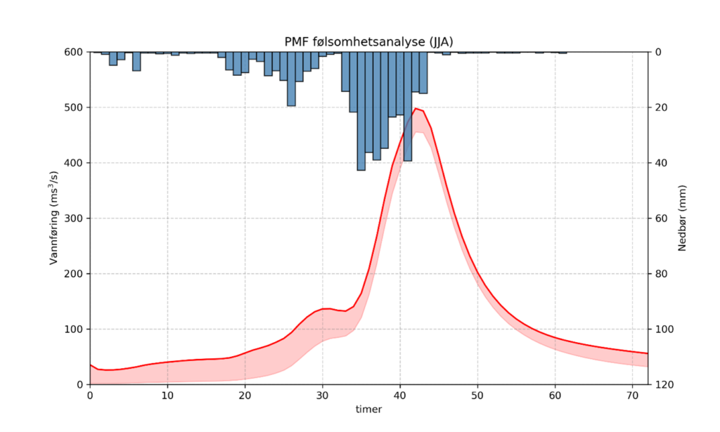
For extreme events, I pay close attention to the rare end of the spectrum and try not to be overly anchored to what’s happened before. Sometimes that means supplementing gauged records with regional flood frequency analysis, stochastic weather generation or even using analogues. It also means being honest with stakeholders about uncertainty, telling them, ‘The model suggests X, but here is the range, and here is what we’re less confident about.’ Communicating that uncertainty well is as important as quantifying it.
Growing up in a place where drought and flood could follow each other in the same season taught me early that water doesn’t always play by the rules you expect. That shapes how I approach modelling, with a healthy respect for what we don’t yet know, and a reluctance to treat any single scenario as the answer.
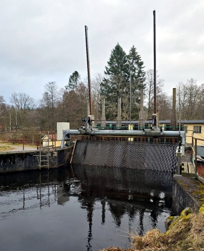
Q: You’ve worked extensively with hydropower systems – how does hydrological modelling help optimise reservoir operations, predict inflows and ensure both energy production and environmental requirements are met?
Hydropower is a beautiful application of hydrological modelling because it sits right at the intersection of natural systems and engineered infrastructure. The reservoir doesn’t care about your generation schedule; it responds to whatever the catchment sends it. The modeller’s job is to bridge that gap: translating what nature is likely to deliver into something operators and planners can act on.
Inflow forecasting is the foundation. At short time scales, hours to days, you need reasonably accurate forecasts so operators can schedule generation, manage flood risk and coordinate with the grid. At longer time scales, seasonal to annual, you need probabilistic inflow sequences so planners can optimise storage trajectories, schedule maintenance and negotiate energy contracts with some confidence.
In markets like the Nordics, this is particularly critical because energy demand and water availability are out of phase: peak electricity consumption falls in the dark, cold winter months, while peak inflows arrive with the spring snowmelt. Operators must store water through the wet season to generate through the dry one and getting that balance wrong is expensive.
Optimisation is where it gets interesting. You’re balancing competing objectives: maximise energy revenue, maintain adequate flood buffer in the reservoir, guarantee downstream environmental flows, honour water supply commitments and keep the turbines operating within their efficient range.
Hydrological modelling feeds into optimisation frameworks, sometimes rule-based, sometimes using stochastic dynamic programming or simulation-optimisation approaches, that help operators navigate those trade-offs systematically rather than by instinct alone.
Environmental requirements can be non-negotiable, and rightly so. Rivers downstream of dams need flow, for ecosystems, for communities, for the long-term health of the system that ultimately sustains the hydropower scheme itself. The model helps you design operating rules that meet environmental flow targets without unnecessarily sacrificing generation. Done well, it’s not a zero-sum game. It’s about finding the operating space where energy and ecology can coexist.
What I find most rewarding about this work is its directness. A better inflow forecast means less unnecessary spilling, which means more energy from the same water. A well-calibrated seasonal outlook means smarter storage decisions and fewer costly surprises. Good long-term forecasting remains something of a holy grail in the field, an eternal quest, but one where every incremental improvement has tangible value.
Q: What originally motivated you to specialise in water resources engineering and hydrology, and what keeps you engaged in it today?
I grew up on a farm in South Africa where water was the thread that ran through nearly every conversation. Too little and the crops failed, the cattle suffered, and there was a tension in the house you could feel even as a child. Too much and the rivers would rise and take crops, roads, and sometimes livelihoods with them. Water was never something abstract to me, it was the factor that determined whether a year was good or hard.
That left a mark. When I got older and discovered there were people who studied how water moves, who built tools to predict and manage it, something clicked. Here was a discipline that combined things I loved, the outdoors, understanding how natural systems work, solving practical problems and it genuinely mattered to people’s lives.
What keeps me in it is partly the science. Water is endlessly fascinating. It’s the universal solvent, behaves unlike any other common liquid and is the substance that makes life possible. It shapes landscapes, drives weather, facilitates transport and generates energy. The way it moves through a catchment touches physics, chemistry, biology, geology and meteorology all at once. You never run out of things to learn.
But more than the science, it’s the relevance. The world’s water challenges are growing, not shrinking. Climate change, population growth, ageing infrastructure, competing demands, these pressures mean that good hydrological modelling is more valuable now than it has ever been. There is no shortage of important problems to work on. Being at DHI means I’m usually close to the coalface, working together with authorities, municipalities, companies and operators who have to make the decisions.
And then there’s the technological shift that’s underway right now. The truth is that the core structures of conceptual hydrological models would still be recognisable to someone from the 1970s. There have been advances, distributed and semi-distributed approaches, better coupling of surface and subsurface processes, probabilistic frameworks that weren’t computationally feasible a generation ago, but the underlying philosophy of representing catchment behaviour through simplified stores and fluxes has proved remarkably durable. The biggest leaps forward, arguably, have come on the input side: remote sensing, radar rainfall, satellite snow products, reanalysis datasets. These have transformed what we can feed into a model.
Now machine learning is opening another door. It is worth remembering that the idea itself is not entirely new: some of the earliest operational spring flood forecasts in Sweden during the 1920s and 1930s were based on simple regression equations, statistical relationships between measured snow storage and total spring runoff.
What held data-driven approaches back for decades was data availability. You can’t train a model on data you don’t have. But computing power was part of the story too, the methods need both the data and the hardware to learn from it. We’ve now reached a point where both are in place, and the observational record, combined with reanalysis products and remote sensing, is deep and broad enough to do serious work.
The interesting question, and the one that keeps me thinking, is where this goes next. ML models are powerful interpolators, but they struggle to extrapolate beyond the conditions they were trained on, which is precisely what climate change demands of us. The future, I suspect, lies in hybrid approaches: models that combine the pattern-recognition strength of machine learning with the physical consistency of process-based hydrology. That’s a frontier worth working on.
And if I’m honest, there’s still a part of me that’s just the kid on the farm, watching a thunderstorm roll in across the veld, wondering where all that water will go and whose lives it will touch along the way. That curiosity hasn’t faded. I hope it never does.