

Modelling in practice is a new series at DHI that explores how modelling helps us interpret complex water environments and turn scientific insights into practical decisions.
In this Q&A, we are joined by John Oldman, who brings over four decades of experience in water quality modelling. He shares insights into what water quality modelling involves and how it is being applied across environmental and water management today.
Q: For someone new to the topic, how would you explain water quality modelling in plain language?
Water quality models are mathematical representations of both the physical nature of a particular aquatic receiving environment (e.g. lake, estuary, harbour, open ocean) and the complex, often interactive, water quality processes that can occur within it. Water quality processes can be either chemical (e.g. enhanced settling of sediment due to changes in water salinity) or biological (e.g. algal growth, breakdown of pathogens).
The combined physical, chemical and biological characteristics of a body of water determine how much capacity the system has to absorb (or assimilate) some level of contamination without showing any long-term broad scale degradation, enabling it to support a broad range of aquatic life without any loss of biodiversity.
Essentially, water quality models are used to estimate the current state of a body of water and what level of impact changes to existing or future contaminant loads may have on it.
Simple water quality models can be built based on an understanding of how water moves into, out of and within a particular body of water. This is determined by the effects of tides, winds and waves on the body of water being considered, the effect of runoff from both urban or rural land following rain events and the input of water from, for example, industrial, wastewater treatment or desalination plant discharges.
By understanding how water moves within a system, we can quantify how contaminants associated with that water may impact a particular body of water – but such relatively simplistic models do not consider biological or chemical processes.
Q: How do water quality experts balance environmental complexity with the needs of a specific project, and what tools help support that?
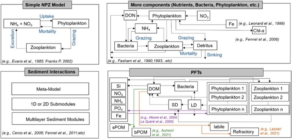
Water quality models can get extremely complex, and the role of a water quality expert is to build a modelling framework that considers both the environment and the problem that needs to be addressed and understood. The MIKE ECO LAB software provides both a range of water quality templates and the ability to code in customisable water quality processes that may be required for site-specific issues. The figure below is from a highly recommended review paper of biogeochemical models in Frontiers in Environmental Science and shows how MIKE ECO LAB can be used to build the right level of complexity into a water quality model to suit a particular project, site or water quality issue.
Q: What kinds of questions or problems can water quality models help answer that would be hard to understand from measurements alone?
There are two primary problems that water quality models can be used for.
They can be used to guide what can be done to improve existing water quality or they can be used to ensure any potential contaminant loads from future development or activities do not lead to degradation of a particular receiving environment.
Observational data provides the basis for calibrating models, and it provides valuable information about water quality that has occurred under historic conditions – e.g. given land use and discharges.
Water quality trends from observational data can be used to estimate how water quality may change in the future. Such data only offers a snapshot of conditions at limited sites under certain conditions – it cannot be used to tell us how future water quality may change due to, for example, changes in land-use due to population growth and urbanisation within a catchment, effects of planned mitigation options or planning regulations or improvements in discharge water quality due to uptake of new technology.
This is where well calibrated water quality models can be used. For example:
- How might proposed land-use change within a catchment affect water quality outcomes in a particular aquatic receiving environment?
- What areas of a catchment should be targeted in the short-term to provide meaningful positive water quality outcomes and what actions should be planned to achieve aspirational outcomes in the longer-term?
- What level of production of proposed fish farms and/or mussel farms is sustainable in terms of maintain good water quality and minimising any environmental impacts?
- What improvements to WWTP treatment processes will need to happen to offset the need for increase discharges under future population growth so that water quality is maintained/improved?
Q: One of your specialisations is near‑ and far‑field mixing. Can you briefly explain the difference, and why both matter when assessing outfalls, discharges or spills?
Near-field models simulate the dynamics of a discharge plume in the immediate vicinity of a discharge.
Such models consider the buoyancy effects of the discharge – a freshwater discharge will rise to the surface in saline whereas as will a heated discharge. They also consider the jetting properties of the discharge and how the momentum of the jet influences the ambient water.
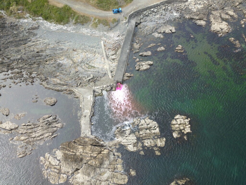
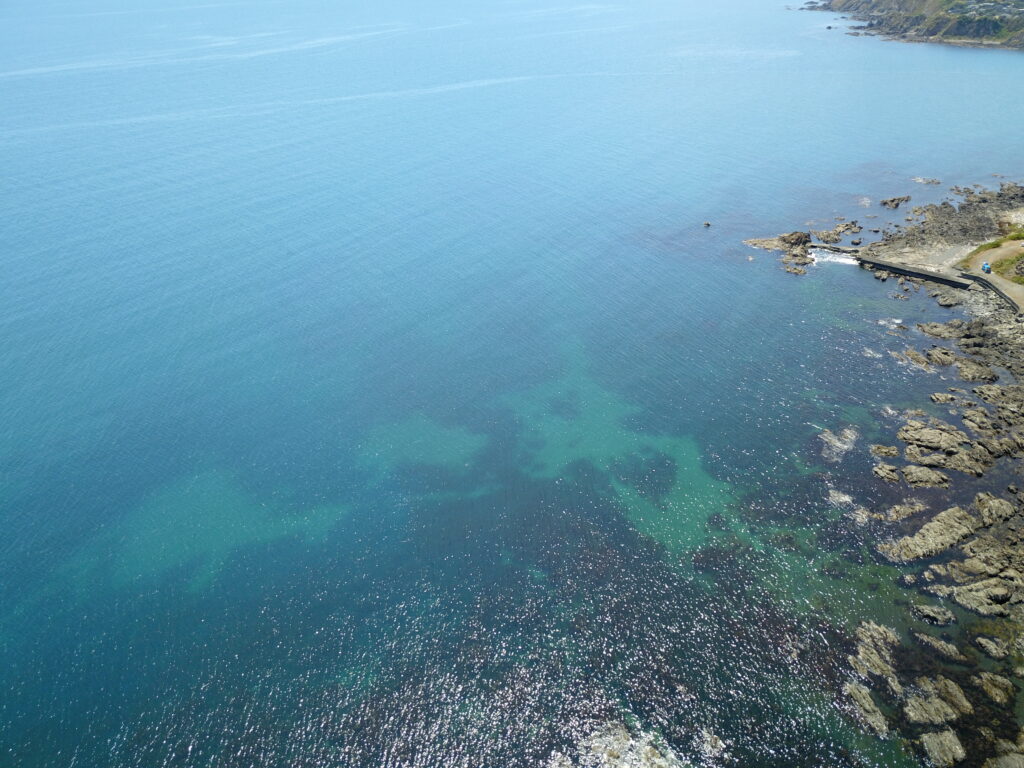
For example, the image below shows an aerial photo of a relatively small, treated wastewater discharge into a subtidal rock pool. In this case, data from the dye test was used to ensure the discharge was well schematised in the model of the area. Results from the model simulations were used to assist in designing ongoing monitoring in the immediate vicinity of the discharge.
Larger discharges typically have larger near-field regions. The image below shows the effect of the Auckland City’s largest WWTP discharge. Because of the magnitude of the discharge (20 m3/s), the near-field region for this discharge is of the order of 500-1000m, with the jetting effect of the discharge clearly visible from satellite imagery!
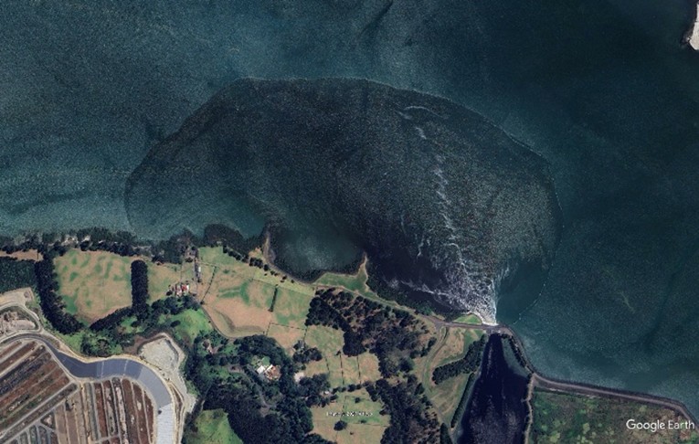
Source: Google Earth imagery © Google
Beyond the near-field region of a discharge (the far-field), the effects of the buoyancy and/or the momentum of the discharge become negligible. The movement of the discharge plume in the far-field is determined by the physical setting of the receiving environment (tides, winds and waves again!).
In both the studies illustrated above, far-field models were used to determine what level of contaminants occurred at key sites remote from the discharge itself.
For example, for the Titahi work, estimated pathogen concentrations at nearby recreational beaches and shellfish beds were used to show that the public health risk from the highly treated wastewater discharge were very low. Similarly, for the Mangere discharge, results from the far-field model were used to provide estimates of the relative influence of the discharge on nutrient levels in the context of catchment derived nutrients.
Q: From your own work, what first drew you to water quality modelling, and what continues to fascinate you about it today?
Living in New Zealand, you are never far from the water, and I have always had a strong connection to being in or on the water – kayaking, diving, sailing, fishing, paddle boarding, open water swimming.
A key moment for me was when I was still at school and being given a presentation from a local Council water quality expert explaining the work they did. That inspiration and my science background at school (maths, physics, chemistry and biology) lead me to study Physics and Maths at university which gave me the skills to consider taking up numerical modelling as career, which I started with a Technical/Scientific Diver role – combining my love of being on and in the water and making a start with using DHI models!
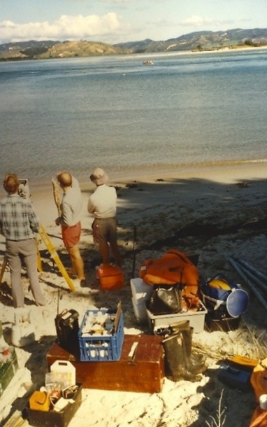
One of the key things I enjoy about working at DHI is the innovation and ongoing development that goes into the MIKE models and my career has, sort of, followed the history of MIKE development.
One of the first models I ran was using the SYS21 hydrodynamic model back in the 1980s. Back then hydrodynamic models ran in almost real-time – results from a couple of tidal cycles would take overnight (or longer) to run and simulating complex water quality processes would have been out the question!
Today we run multiple year, complex water quality models in a matter of days and have the post-processing tools to extract huge amount of information and deliver digital solutions that provide clients with the insight into what can be achieved with well calibrated water quality models.
A prime example of the digital solution aspect of what we do with water quality models is the ongoing CREST work we are doing for various Councils in New Zealand including work in Auckland where we have linked catchment models and harbour models to provide the client with an online tool to provide them with an understanding of the effect of changes in contaminant loads on the marine receiving environment.
Learn more about our work with Auckland Council to restore the city’s coastal water quality: Healthy harbours in Auckland