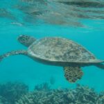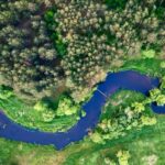

Effective marine resource management is crucial for safeguarding our oceans, which are essential for biodiversity, climate regulation and the livelihoods of millions of people. With over 70% of the Earth’s surface covered by water, marine ecosystems like coral reefs, mangroves and seagrasses provide vital services—ranging from carbon sequestration to food production. Yet, these resources are increasingly under threat from overfishing, pollution and impacts from climate change, among other threats. Without proper management, we risk losing these valuable ecosystems and the benefits they provide.
In many developing countries, however, limited resources, expertise and budgets hinder large-scale, effective management of marine resources. Having up-to-date, science-based information empowers stakeholders to actively engage in negotiations and advocate for sustainable solutions. This is especially urgent in places like Semporna, one of the most biodiverse marine regions on Earth, facing increasing threats from tourism development, unsustainable fishing methods and climate change.
In 2023, a DHI project on mapping marine habitats with satellite data in Semporna (Sabah, Malaysia) was announced as one of four projects selected in the third cohort of the UNDP Ocean Innovation Challenge (OIC). This is a call to address real-life challenges in marine protected areas, area-based management and the blue economy, which are fundamental to accelerate SDG 14.
Transformational satellite-based innovation – a tropical application
Emerging technology, such as remote sensing, has transformed how we measure and monitor Earth’s surface. In this case example, DHI, in partnership with local NGOs Reef Check Malaysia and Stop Fish Bombing Malaysia, has developed MCSAV (Mangroves, Corals and Submerged Aquatic Vegetation), an interactive web-based platform combining remote sensing technology and human-assisted machine learning that empowers stakeholders to map and monitor these critical aquatic biotopes.
Initially developed for nationwide SAV mapping in high-latitude regions in Sweden, the platform has been successfully replicated in tropical systems, such as Semporna, known for their diverse and productive marine ecosystems.
The project demonstrates four key innovative features of remote sensing as follows:
- Replicable and scalable: enables stakeholders to monitor marine resources at time and space scales tailored to their management objectives
- Human-in-the-loop: allows flexibility by incorporating additional data inputs, such as field observations and local knowledge, to refine the model and improve accuracy over time
- Cost-effective: utilises publicly available satellite datasets, reducing costs while providing access to current, high-quality data
- User-friendly: no expertise or experience in remote sensing data processing is required

Empowering stakeholders with remote sensing technology
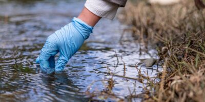
Local community involvement is an essential and integral component of this partnership. Local youths actively involved in marine conservation programmes have been engaged to contribute to the project through field data collection. The local knowledge is invaluable to improving the model’s accuracy and habitat classification. Such a participatory and inclusive approach fosters knowledge exchange and skill development and promotes long-term commitment to protect and conserve marine habitats.
Now, resource managers, marine conservationists and local communities can generate up-to-date marine habitat maps within minutes. With a shared common baseline, this technology-stakeholder partnership supports informed decision-making and facilitates collaborative and effective planning, management and monitoring of marine habitats within and outside protected areas.
More than just mapping
Beyond mapping, remote sensing technology lays the groundwork for nature-based solutions, e.g., tracking and quantifying blue carbon in coastal ecosystems (mangroves, seagrasses and tidal marshes) and facilitates the restoration of these habitats and climate mitigation. Find out more about the MCSAV technology.
About the authors

Malinda Auluck, Senior Environmental Consultant
Malinda Auluck is a senior environmental consultant at DHI Malaysia and the project manager for this innovative initiative. Identifying as a generalist, she focuses on finding practical solutions to a wide range of environmental challenges, including sustainable resource management, pollution reduction and mitigating the impacts of climate change. Passionate about collaboration, she strives to drive positive change and foster a healthier, more sustainable future for all.
Tang Chung Ngo, Graduate Environmental Consultant
Tang Chung Ngo is an environmental scientist at DHI Malaysia. With a strong interest in environmental conservation, she is enthusiastic to learn and make meaningful impacts on environmental challenges like sustainable coastal management and biodiversity loss.