

Sea level rise due to climate change is one of the contributing factors of salinity intrusion, particularly for shallow sandy aquifers in water stressed coastal areas. In many of such areas surface water salinity is additionally increased due to reduced upstream discharges and salinity can intrude both directly from the sea and from the surface waters. Furthermore, a temporarily rise in sea level can be caused by various acts of nature, such as tsunamis and hurricanes bringing about storm surges. Due to ongoing evaporation, the salt concentration of water in sandy aquifers have the potential to increase exponentially and eventually cause contamination or environmental problems.
Setting up a groundwater salinity model to assess climate change impacts
One of the best ways we have found to assess climate change impacts is to set up a groundwater salinity model to simulate the behaviour of salinity propagation in the shallow aquifer system of a study area. Mathematical modelling is a useful and tested method to understand the mechanism of river and coastal hydraulics along with its salinity distribution. In the case of insufficient model input data, an action plan for primary data collection needs to be in place.
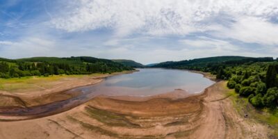
Real-life study in Bangladesh
A case study undertaken in Southwest Bangladesh to assess climate change impacts on groundwater salinity saw 27 groundwater observation wells – including 24 wells in 12 lines across three major rivers – installed due to limitations in model input data.
Data collection was carried out for one hydrological year. At the same time, auto recorders were installed in each line wells along with a river gauge station, and hydro-chemical investigation on groundwater salinity from selected existing tube wells was also carried out pre-and post-monsoon season. Other relevant data for the model development were collected from secondary sources.
It was revealed that the low salinity zone (< 1000 ppm) lay along the western part of the study area and the high salinity zone (> 1000 ppm) lay along the southern and eastern sides. The long-term simulation for climate change options for 2050 indicated propagation of salinity from river to aquifer. In the study area, groundwater salinity varied from 250 mg/l to 5500 mg/l. Under climate change conditions in the year 2050, the area of fresh water zone (salinity < 1000 ppm) would decrease as compared to present conditions. Within the saline zone, the area under severe salinity (salinity > 2000 ppm) is projected to increase by 14% in the year 2050.
The type of groundwater salinity model that was used in this study can be developed with a modelling software such as FEFLOW. To describe the interaction of surface waters and the aquifer (water quantity as well as salinity), additionally a coupling with a river modelling software such as MIKE 11 or MIKE HYDRO River can be implemented. The model can be used to study and estimate the impact of climate change, water usage and other scenarios on the aspects of groundwater salinity and can form the basis for the adaptation of proper measures to address burning groundwater issues – now and in the future.
Watch this presentation video to know more about the Bangladesh study.
*Article adapted from Hasan et al., FEFLOW 2015 Conference, Modelling the World of Groundwater with MIKE by DHI, Berlin 21 - 25 Sep. 2015