
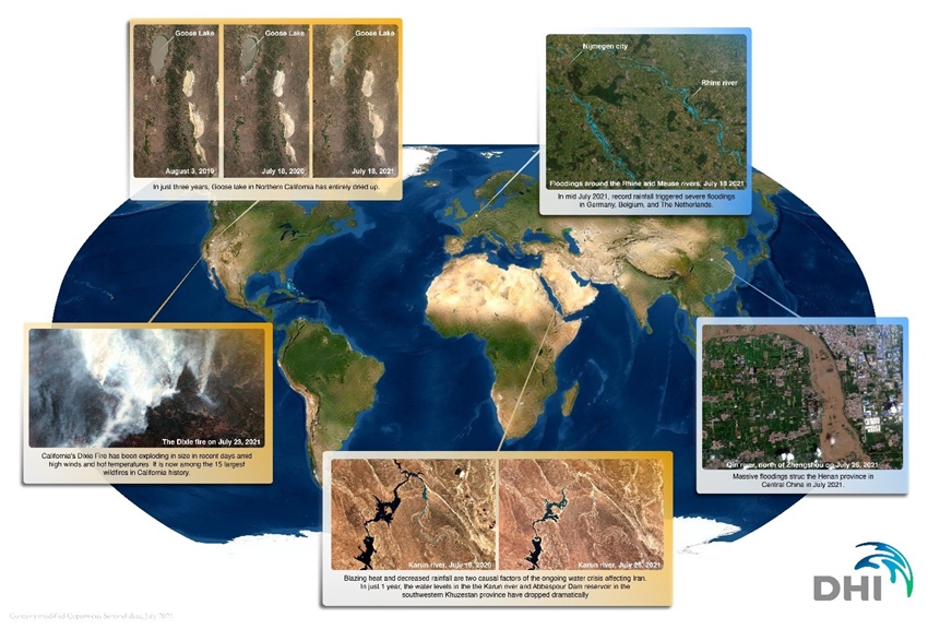
Roughly 5500 satellites are orbiting above us right now. Most of these satellites are used for communications, but they are also vital instruments for measuring and monitoring the earth’s terrestrial, aquatic and climatic environments. In fact, more than 20% of all satellites in orbit (more than 1100) are used for Earth Observation (EO), which is basically gathering of information about the Earth’s physical, chemical and biological systems[1].
Satellites have collected data on our planet for over 50 years, and the collective data archive provides a powerful basis for analysing and documenting trends and changes on Earth. As a result, satellite data is key for measuring, monitoring and documenting sustainable development outcomes as well as informing actions and policies by delivering actionable information and insights.
How to link satellite data with sustainability objectives
Satellite data can enrich decision-making across all environments and domains in many different ways. The data can:
- Provide near real-time data and information on inaccessible locations worldwide as well as operational data to underpin time-critical applications
- Be used as an integrated component in advisory services, as calibration/validation data for modelling purposes and as an objective and timely source to fill data gaps (both spatially and temporally) and replace outdated data
- Map and monitor terrestrial and water environments in both near real-time and historically, at scales from the local to global levels
As a further step, some of these applications can contribute directly or indirectly to the global sustainability agenda and the UN Sustainable Development Goals (SDGs).
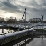
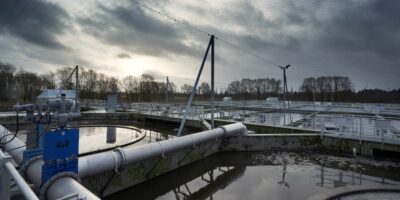
Sustainable water management with data-based decision-making
Following previous years, the summer of 2022 has been a stark reminder of the harsh reality and impacts of our increasing water scarcity challenges, with extreme heat and droughts events as well as increasing competition for water frequently featured in news headlines. This is a powerful reminder of the urgency of addressing global water issues. And the satellites can help.
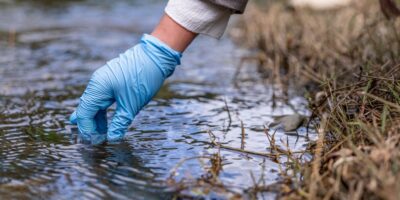
The use of satellite data to monitor water resources is increasingly being recognised and accepted as a viable source of information for practitioners and decision-makers. In DHI, we work with countries worldwide as well as directly with custodian agencies of the SDG 6 (clean water and sanitation for all) indicators to ensure best-practice use and application of satellite data to inform sustainable water resource management.
SDG indicator reporting with Earth Observation data
To give you some real-life examples of how EO data can be used to support SDG indicator reporting, I do not need to look further than my own workplace. Since 2016, DHI has been directly involved in the formulation and demonstration of methodologies for reporting on the SDG goals and targets through the use of EO-based approaches. This includes being lead author on the ‘Compendium of Earth Observation contributions to the SDG Targets and Indicators’ and project lead on several national pilot projects to demonstrate the value of EO for SDG indicator reporting (e.g., EO4SDG, GlobWetland Africa and GPSDD wetlands extent monitoring Uganda).
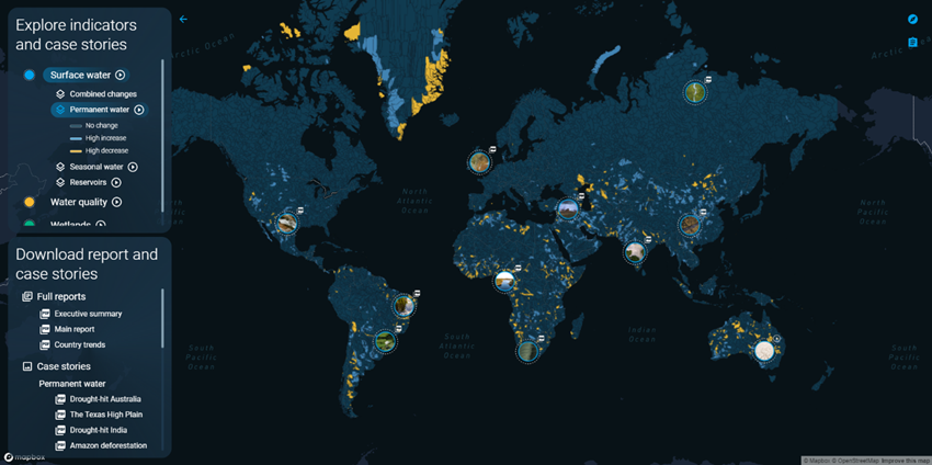
Currently, DHI is assisting United Nations Environment Programme (UNEP) with various activities in support of SDG 6 (Clean water and sanitation) such as maintaining, updating and extending the Freshwater Ecosystem Explorer (SDG661.App) and the data science behind the progress reporting on SDG indicator 6.6.1 on changes in water-related ecosystems. We also conduct analysis of SDG 661 sub-indicator data to determine global, regional, sub-regional and country-case study/waterbody trends.
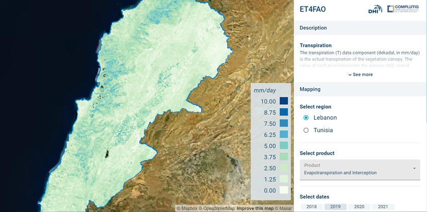
At the same time, DHI is working with the UN Food and Agriculture Organization (FAO) – the custodian agency of SDG indicator 6.4.1 – to demonstrate use of the latest models and data for their water efficiency monitoring portal WaPOR.
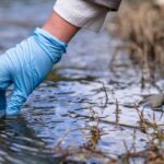
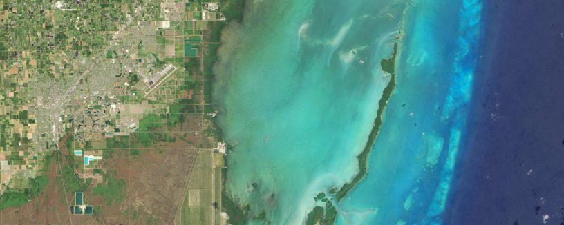
Mapping and monitoring surface water bodies
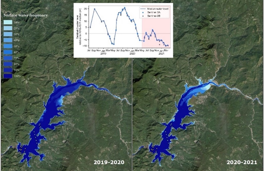
The aim of the WorldWater project, funded by the European Space Agency (ESA), is to empower national authorities and river basin organisations with EO data and tools to independently monitor surface water dynamics at all scales. This essential information allows for more evidence-based planning and management of water resources and an ability to efficiently report and act in response to the global water agenda. The project team used all freely and openly available satellite data streams of both optical and radar satellite imagery, as well as inland water level observations from satellite radar altimetry, to develop a series of novel EO methods and tools for monitoring surface water changes in both extent and volume. By embedding these products and tools into national processes for more data-driven decision-making and improved monitoring frameworks, they significantly contribute to achieving the global water objectives.
Delivering satellite-based information to improve water resource efficiency
With increasing pressure on freshwater resources, and up to 70% of those resources used in crop irrigation, it is critical to monitor and improve crop water use efficiency from field to national scales. Satellite-based data for evapotranspiration estimations at field level supports informed decision-making with regards to critical water resources. Decision-makers can achieve improved water use efficiency within several domains, including irrigation management, by having an indication of areas where crops experience water stress.
In DHI, we are evolving our evapotranspiration and crop water needs products into applications for water resource management and exploring new operational services to strengthen the entire value chain of the agricultural and forestry sector. We have already demonstrated the feasibility of using evapotranspiration tools to provide operational monitoring solutions for agricultural water use at national levels.
Another key parameter that plays a central role in the water, energy and carbon cycle is soil moisture. Soil moisture is key for understanding many different environmental and socio-economic processes, e.g., impacts on vegetation vitality and health, crop yield, drought or risk of flooding. While conventional EO-based products on soil moisture do exist, they are commonly associated with a number of limitations. Often, the resolution is too coarse (1 km), making them less suitable for describing local conditions. They also typically ‘only’ measure the top 5-10 cm of the soil. In other words, they do not represent the conditions at the root zone.
Building on the evapotranspiration approach, we have developed a tool to assess actual soil moisture content in the entire rootzone, in up to 50 m resolution. The method is highly scalable and was recently applied to produce long-term timeseries of volumetric soil moisture data for all of Denmark. This was carried out in collaboration with the Danish Environment Agency. The national data is publicly available from https://www.soilmoisture.io/.
EO is not ‘just’ for water
While EO data has tremendous potential in assessing and monitoring water-related variables at scale, satellite data is also used to support decision-making processes for non-water related sustainability challenges.
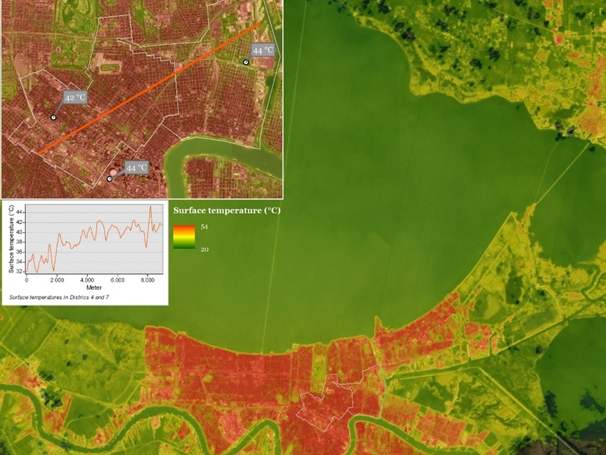
In a series of research projects funded by ESA, most recently the GreenUP project, we have applied satellite data to inform decision-making processes in urban areas. Frameworks and tools can be used to dynamically assess the state and dynamics of urban environments, including monitoring of the extent and condition of green/blue infrastructure, mapping urban heat island (UHI), flood risk mapping and much more. Collectively, these tools hold significant potential to inform urban climate activities as well as green spatial planning through site identification and monitoring of nature-based solutions. This is key to inform planning of more liveable, sustainable and resilient urban areas.
In another project, we are developing a new high-resolution, satellite-based portfolio of tools to measure rangeland indicators, including rangeland extent, type and biomass. This ability to systematically and accurately monitor rangeland indicators will be key to assess how rangelands change as a consequence of both human changes (land use and grazing patterns) and climate changes such as erratic rainfall patterns, temperature and atmospheric CO2. This is key to understand and protect these critical ecosystems.
Curious about satellite technology and sustainability issues? Contact Mads Christensen for more information.
[1] Earth observation (europa.eu)